
The Remarkable Stability of Plum Island
October 24, 2016 by Chris Hein
Gloucester Point, VA 25 October 2016
I received an email yesterday from friend of the project and local science author Bill Sargent (author of this recent book on the geologic and human history of Plum Island), and it really drove home to me something very unique about Plum Island . . . it doesn’t move.
|
Chris Hein & Andy Fallon collecting a core through 2000-year-old marsh near Sandy Point State park, Plum Island, MA. |
You see, Bill found on the beach of Castle Neck some prehistoric oyster shells. They washed up on the beach probably after being eroded from somewhere else in the Plum Island / Coffin’s Beach system. We don’t know quite where and we have not yet dated them (using 14-C or “radiocarbon” dating) to see when they first formed, but it is possible they have been around for thousands of years. They formed alongside the marshes and tidal flats behind the barrier islands, and were probably buried by sand thrown up and over the dunes during a big storm. This process, called “overwash”, and I wrote about how it doesn’t really happen much on Plum Island in a blog post two years ago.
But, overwash once DID happen. In fact, Plum Island used to be much less stable than it currently is. 4000-5000 years ago Plum Island was a set of small, narrow islands that migrated landward, covering the marsh and bays behind it. Eventually, due to both a decrease in the rate of sea level rise and the continued delivery of sand from the Merrimack River, the island stopped moving landward, stabilizing in its current position ~3500 years ago. It stopped overwashing and burying marsh, and by 2500 years ago had started instead building wider and higher; this was the topic of my 2012 paper on Plum Island written as part of my PhD work.
So, about those oyster shells Bill found . . . well, those may have been eroded out of the modern beach of Plum Island, after having been buried for 2500 years or more. How do we know this date? Well, a few years ago, Andy Fallon & I collected some samples of marsh that we found in the surf zone on southern Plum Island, at the beach near Sandy Point State Park. This summer we dated that marsh with radiocarbon dating and found that it is ~2100 years old. In other words, Plum island migrated landward (west), buried that marsh – which was on the back side of the island – 2100 years ago, and then sat there on top of that marsh for all that time in between. Only now, a little erosion at the southern end of Plum Island has excavated that marsh, this time on the FRONT of the island.
|
Young ( |
This happens all over the place. Down in Virginia where I spent a lot of my time studying barrier islands, you can find marsh popping out on the beach on almost every barrier island. The difference? That marsh is only 50-100 years old, as opposed to >2000 years as we find on Plum Island!
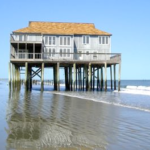
So, what’s the difference? Well, despite what appears to be very severe erosion on Plum Island which has caused the loss of ~8 houses over the last 10 years, Plum Island is a very stable barrier island. It DOESN’T move! It has been sitting in the same place for literally thousands of years. Compare that to Cedar Island in Virginia: that beach retreats landward at a rate of ~30 feet per year.
Why? Well, we can thank the Merrimack River: that river has been pumping out large quantities of sand for thousands of years . . . . 12,000 years ago it was much more than today, and the amount of sand is less today than it was in 1800, before all of the dams on the river. But, it still delivers ~38,000 yd3 of sand every year, That sand gets reworked along the beach, nourishing it naturally, and helping the beaches and dunes of Plum Island keep up with rising sea level.
Down in Virginia we have no such river feeding our barrier islands. Their sand comes from erosion of cliffs . . . in Delaware. Without a fresh supply of sand from a river, those barrier islands erode and migrate . . . and not coincidentally, there are no longer any communities living out there.
So, go ahead and check out those ancient oysters on Castle Neck. Drive down to Sandy Point, walk to the beach at low tide, and look for the 2000-year-old marsh partially buried in beach sand. And think about just how remarkably stable Plum Island actually is . . . and the real challenges it would face if not for the Merrimack River.
 Posted: February 18, 2017